
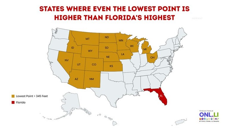
Florida is famous for its beaches, wetlands, and remarkably flat landscape. This map highlights a surprising comparison: several U.S. states are so elevated that their lowest natural point sits higher than Florida's highest natural point. Florida's highest elevation is Britton Hill, which rises just 345 feet (105 meters) above sea level—the lowest state high point in the United States.
Most of the highlighted states are found in the Mountain West and northern Great Plains, where even valleys and river basins remain at relatively high elevations. States such as Colorado, Wyoming, New Mexico, Utah, and Nevada are known for their towering mountain ranges, but this map emphasizes that their entire landscapes are elevated, not just their highest peaks.
A few states on the list may come as a surprise. Kansas, Nebraska, North Dakota, and South Dakota are often associated with broad plains rather than rugged mountains, yet their lowest elevations are still above 345 feet. Their position on the Great Plains means the land gradually rises westward from the Mississippi River, resulting in a much higher average elevation than many people expect.
One particularly interesting example is Colorado. While it is famous for having more than 50 peaks above 14,000 feet (4,267 meters), even its lowest point along the Arikaree River sits at approximately 3,315 feet (1,011 meters)—nearly ten times higher than Florida's highest point.