
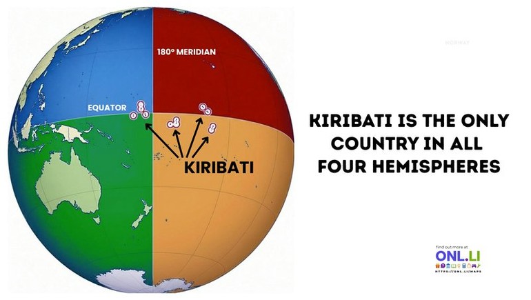
This map highlights one of the world's most unusual geographic facts. Kiribati is the only sovereign country that lies in all four hemispheres at once—Northern, Southern, Eastern, and Western. Its scattered islands stretch across a vast area of the central Pacific, crossing both the Equator and the 180th meridian.
Kiribati's unique geography is the result of its 33 coral atolls and islands being spread across more than 3.5 million square kilometers of ocean. Although the islands themselves cover only a small amount of land, they are dispersed so widely that the country occupies parts of all four hemispheres, making it unlike any other nation on Earth.
The country's unusual position also led to an important timekeeping change. In 1995, Kiribati shifted the International Date Line eastward within its own territory so that all of its islands would share the same calendar day. This eliminated the odd situation where different parts of the country were nearly a full day apart despite belonging to the same nation.
One interesting detail is that Kiribati was the first country on Earth to welcome the year 2000. Its eastern Line Islands, including Kiritimati (Christmas Island), became one of the first inhabited places to celebrate the new millennium because of the country's adjusted time zone.
Maps like this show how political boundaries and geography sometimes combine to create truly unique places. Kiribati may be small in population, but its position on the globe makes it one of the most geographically remarkable countries in the world.
#MapsObsession #Kiribati #PacificOcean #WorldGeography #Cartography #Equator #180Meridian #GeographyFacts #WorldMap #GeographyMatters